
Journal of Resources and Ecology >
Intelligent Identification of Building Patches and Assessment of Roof Greening Suitability in High-density Urban Areas: A Case Study of Chengdu
|
LUO Luhua, E-mail: luoluhua_hua@163.com |
Received date: 2021-02-09
Accepted date: 2021-10-24
Online published: 2022-03-09
Supported by
The China Postdoctoral Science Foundation(2019M650830)
The National Key Research and Development Program of China(2016YFC0502903)
The National Key Research and Development Program of China(2017YFB0504201)
The Seed Foundation of Tianjin University(2021XSC-0036)
The Natural Science Foundation of Tianjin(19JCYBJC22400)
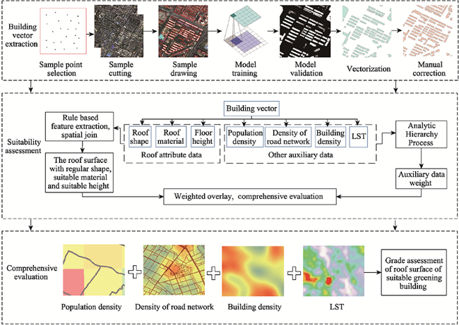
With the expansion of a city, the urban green space is occupied and the urban heat island effect is serious. Greening the roof surfaces of urban buildings is an effective way to increase the area of urban green space and improve the urban ecological environment. To provide effective data support for urban green space planning, this paper used high-resolution images to (1) obtain accurate building spots on the map of the study area through deep learning assisted manual correction; and (2) establish an evaluation index system of roof greening including the characteristics of the roof itself, the natural environment and the human society environment. The weight values of attributes not related to the roof itself were calculated by Analytic Hierarchy Process (AHP). The suitable green roof locations were evaluated by spatial join, weighted superposition and other spatial analysis methods. Taking the areas within the Chengdu city’s third ring road as the study area, the results show that an accurate building pattern obtained by deep learning greatly improves the efficiency of the experiment. The roof surfaces unsuitable for greening can be effectively classified by the method of feature extraction, with an accuracy of 86.58%. The roofs suitable for greening account for 48.08%, among which, the high-suitability roofs, medium-suitability roofs and low-suitability roofs represent 45.32%, 38.95% and 15.73%. The high-suitability green buildings are mainly distributed in the first ring district and the western area outside the first ring district in Chengdu. This paper is useful for solving the current problem of the more saturated high-density urban area and allowing the expansion of the urban ecological environment.
Key words: deep learning; roof greening; suitability assessment; spatial join; weighted overlay
LUO Luhua , CHEN Mingjie , DONG Lulu , SU Wei , LI Xin , HU Xiaodong , ZHANG Xin , LI Chen , CHENG Weiming , SHI Hanning , LUO Jiancheng . Intelligent Identification of Building Patches and Assessment of Roof Greening Suitability in High-density Urban Areas: A Case Study of Chengdu[J]. Journal of Resources and Ecology, 2022 , 13(2) : 247 -256 . DOI: 10.5814/j.issn.1674-764x.2022.02.008
Fig. 1 Technical flow chart of the roof greening suitability assessment system used in this study |
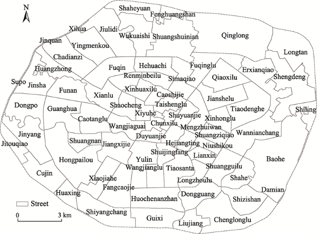
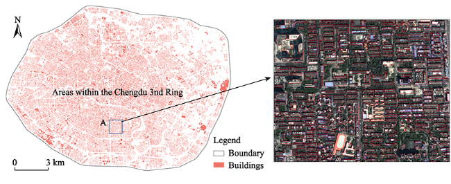
Fig. 2 Overview map of the study area |
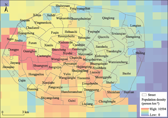
Fig. 3 Population density distribution map |
Table 1 Population density parameter table |
| District | Population density (person km-2) |
|---|---|
| Chenghua District | 7186 |
| Jinniu District | 7090 |
| Jinjiang District | 9788 |
| Longquanyi District | 1284 |
| Qingyang District | 10713 |
| Wuhou District | 10594 |
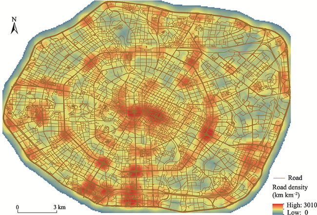
Fig. 4 Road density distribution map |
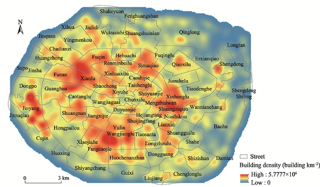
Fig. 5 Building density distribution map |
Fig. 6 Land surface temperature distribution (taking August 11, 2019 as an example) |
Table 2 Features of roofs not suitable for greening |
| Name | Type |
|---|---|
| Irregular shape | 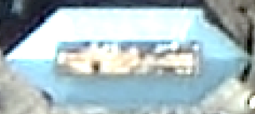 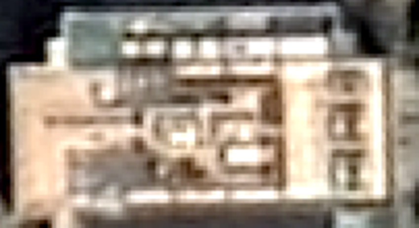 |
| Material mismatch | 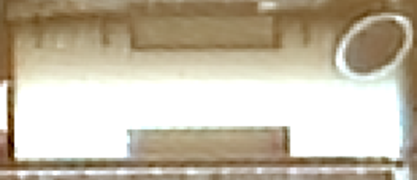 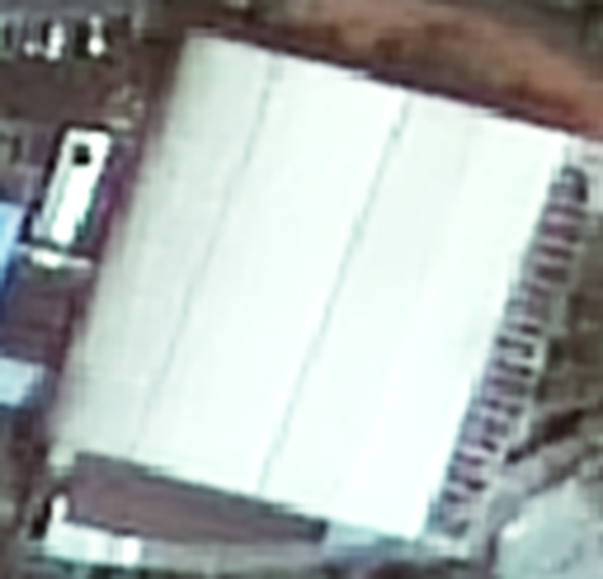 |
| Sloping roof | 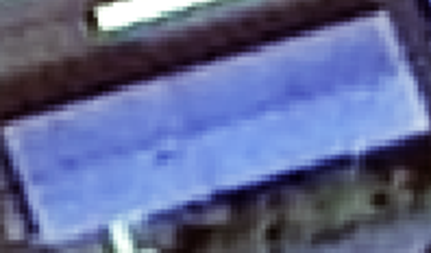 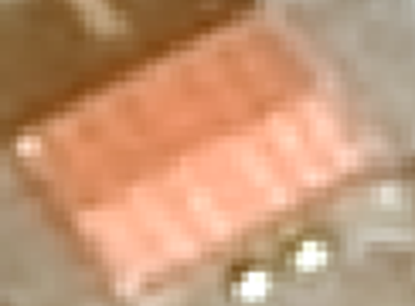 |
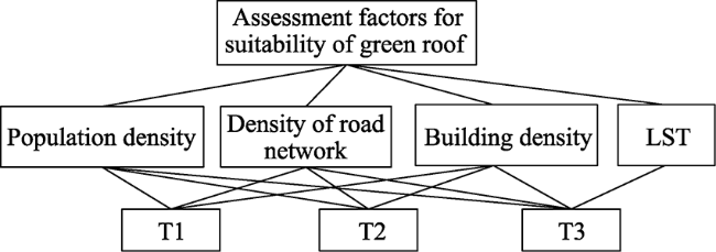
Fig. 7 AHP hierarchy diagram |
Table 3 Index system of roof greening |
| Sub-objective | Indicators |
|---|---|
| Roof attribute characteristics | Floor height Roof shape Roof material |
| Natural environment characteristics | Land surface temperature (A1) |
| Characteristics of the humanistic social environment | Population density (B1) Building density (B2) Road density (B3) |
Table 4 The average random consistency index RI |
| Order | 3 | 4 | 5 | 6 | 7 |
|---|---|---|---|---|---|
| RI | 0.52 | 0.89 | 1.12 | 1.26 | 1.36 |
Table 5 Summary of results of the consistency testing |
| Variable | ${\lambda _{{\rm{max}}}}$ | CI | RI | CR |
|---|---|---|---|---|
| Value | 4.061 | 0.020 | 0.890 | 0.023 |
Table 6 Table of indicator weights |
| Indicator | Indicator weight |
|---|---|
| A1 | 0.3207 |
| B1 | 0.3763 |
| B2 | 0.1881 |
| B3 | 0.1149 |
Fig. 8 Extraction results and local maps of architectural map spots |
Fig. 9 Distribution map of buildings suitable for greening |
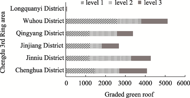
Fig. 10 Statistical distribution of suitability for greening of the buildings by district |
This work was partially funded by LZJTU EP 201806 and the Jiangsu Shuangchuang Project.
| [1] |
|
| [2] |
|
| [3] |
|
| [4] |
EC (European Commission). 2015. Towards an EU research and innovation policy agenda for nature-based solutions & re-naturing cities. Final report of the Horizon 2020. DOI: 10.2777/479582.
|
| [5] |
|
| [6] |
|
| [7] |
|
| [8] |
|
| [9] |
|
| [10] |
|
| [11] |
|
| [12] |
|
| [13] |
|
| [14] |
|
| [15] |
|
| [16] |
|
| [17] |
|
| [18] |
|
| [19] |
|
| [20] |
|
/
| 〈 |
|
〉 |

