Grasslands have critically important ecological and economic values while most of them have been suffering from various degrees of degradation in China due to overgrazing. The “Forage-Livestock Balance” (FLB) policy has been implemented for more than a decade, aims to balance the relationship between forage productivity and grazing consumption of grasslands by livestock. According to the review of statistical data and literatures on policy evaluation, FLB-dominated subsidies for grassland ecological conservation policies are ineffective on grassland restoration, livestock reduction in some overloaded areas and improvement on herdsmen livelihood. To deal with the dilemma, we suggest a fundamental shift of strategy from controlling livestock numbers to maintaining and improving grassland health (MIGH) based on ecological theories, and promote the sustainable development of grassland in China. The results show that, FLB policy failed to obtain expected benefits mainly because it interfered with the herders' autonomous use of contracted grasslands along with the defects of its underlying theory and methodologies. Implementing reward and punishment based on ecosystem health will not only motivate herders to manage their grassland autonomously, but also be more scientific and feasible than FLB.
In the new era of the rapid development of economic globalization and the community of human destiny, the implementation of the “One Belt and One Road” (OBOR) construction model is designed to coordinate environmental protection and economic development. Most of the countries along the Silk Road in the 21st century are developing countries, and the majority of them are facing the same ecological and developmental difficulties as China. In this paper, under the background of the “OBOR” strategy and on the basis of the distribution of global climate types, we selected Central Asia and Northwest China, which have temperate continental climates, as the research objects. We sorted out and summarized the main ecological problems faced by Western China and Central Asia during the development of the “Belt and Road” initiative. At the same time, in combination with the major ecological governance projects implemented in recent years, we proposed key ecological governance technologies that have a certain degree of scalability, such as key technologies for water resource utilization and protection, sand prevention and control, and saline-alkali land governance. The aim was to offer the experiences and a reference for providing technological models for the “one belt along the road” region and the country to build an effective ecological governance system. Two suggestions are then proposed for improving the feasibility and rationality of ecological governance technology in the construction of the “One Belt, One Road”. 1) With the implementation of the strategy of “OBOR” construction, the ecological threats the OBOR countries are facing cannot be ignored. Every country needs to jointly act to build an “OBOR” ecological civilization. 2) The participants must pay attention to the spatial heterogeneity and temporal dynamics of ecological carrying capacity, and provide data reference and support for the reasonable allocation of ecological governance technology.
The ecological and environmental effects caused by land use change have attracted global attention. Huaihai Economic Zone, as the core of the Huaihe River ecological economic belt, has experienced a reciprocal evolution of land use, ecological security and regional economic development. Based on multi-stage land use data extracted by Google Earth Engine (GEE), the spatio-temporal differentiation characteristics of ecosystem service value (ESV) evolution in Huaihai Economic Zone from 1998 to 2018 were analyzed with the help of ESV assessment and a minimum accumulated resistance model (MCR), and the regional ecological security pattern (ESP) was optimized. The results show that ESV intensity has obvious spatial differentiation, which is higher in northeastern China and lower in southwestern China. The median ESV area accounted for the largest proportion, while the high and low ESV areas accounted for a small proportion. The characteristics of EVS temporal and spatial differentiation show decreasing and increasing grades. From the perspective of development period, the ESV grade changes show a positive trend. In the optimization of the ecological security pattern, 26 important ecological sources, 22 main landscape ecological corridors, and 65 ecological strategic nodes were optimized and identified, and the middle-level ecological security zone accounted for the largest proportion. The main reasons for the changes in the ESV and ESP are closely related to the changes in local natural resources and the changes and adjustments in government protection policies. These research results can provide a reference for inter-provincial territorial space protection and the formulation of a sustainable development strategy.
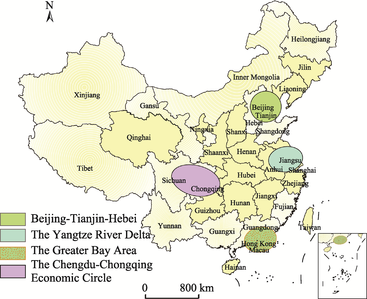
In response to the 14th National Five-year Plan of China and to better explore new strategies for promoting regional coordinated green development, the eco-efficiency values of Chengdu-Chongqing Economic Circle and the corresponding temporal analysis from 2004 to 2018 were assessed in this paper using the super-SBM model and Markov chain. Meanwhile, the spatial analysis of eco-efficiency was conducted by a geographically weighted regression model. Although eco-efficiency has risen at an increasing rate, the economic development of Chengdu-Chongqing Economic Circle was still ecologically ineffective. This means there is an urgent need to improve the efficiency of resource utilization and promote technological innovation. During the study period, the evolution of the eco-efficiency presented as a “π” shape, and was accompanied by the phenomenon of “club convergence”. There was also a strong tendency for eco-efficiency to maintain the original status quo, which indicates that it lacked sufficient momentum for improvement, so it was difficult to achieve a leapfrog transfer. Spatially, the eco-efficiency was distributed from northwest to southeast in a high-low-high manner. The spatial-temporal differences of eco-efficiency narrowed but the effect of agglomeration was relatively weak and there was a polarization trend. Further investigation suggests that the differences in the development level of urbanization, opening, technology, environmental regulation and advancement of industrial structure led to the spatial differences of eco-efficiency. Each city in the Economic Circle should make every effort to improve eco-efficiency accordingly, and thus to promote the green development of the whole region, so as to lay a foundation for driving the green and coordinated development of the central and western regions.
Water resources carrying capacity (WRCC) is an important index for assessing the coordinated development relationship between population and water resources. The quantitative evaluation of WRCC can provide an important basis for water resource regulation and sustainable economic and social development. Based on the statistical data of cities and counties in the Great Dunhuang Region (GDR), and taking counties as the basic units, this study quantitatively analyzed the WRCC and carrying status of the GDR under different water inflow conditions and policy constraints from 2010 to 2017. The study revealed three main trends. (1) From 2010 to 2017, the WRCC of the GDR increased year by year, from 343700, 315900 and 291100 people to 458700, 415400 and 375600 people in normal, dry and extremely dry years, respectively. (2) Under policy constraints, the WRCC of the GDR increased year by year from 309400 people in 2010 to 412400 people in 2017. Based on future estimates, the WRCC of the GDR are expected to be 326600 people in 2020 and 341200 people in 2030. (3) From 2010 to 2017, the water resources carrying index of the GDR was decreasing, and it decreased from 1.05, 1.14 and 1.24 to 0.80, 0.88 and 0.97 in normal, dry and extremely dry years, respectively. The carrying status changed from critical overload to balanced. Although the WRCC and the carrying status of the GDR had significantly improved by 2017, the overall upper limit of the carrying capacity is not high. Therefore, efforts should be made to improve the utilization efficiency of water resources in order to maintain the sustainable utilization of water resources in the GDR.
International investors in large infrastructure projects face numerous risks. To explore this issue, this paper compares the development of two hydropower stations in Rasuwa District, Nepal: Upper Trishuli 3A, which is fully funded by a Chinese government bank, and Rasuwagadhi, which is fully funded by local government banks. The construction of these two plants was compared between 2012 and 2020 using a visual interpretation method to extract data on roads, buildings, dams, and vehicles from 1-m-resolution remote sensing imagery. Two methods were used to compare the environmental impacts of each plant. Landsat 7/8 30-m imagery was used to monitor changes in the normalized difference vegetation index around the Upper Trishuli 3A hydropower station from 2012 to 2020 and around the Rasuwagadhi hydropower station from 2014 to 2020. Then, 1-m-resolution imagery was used to observe land-cover differences in these areas and time periods. The results indicate that: (1) despite various challenges, such as geological disasters, the COVID-19 pandemic, and a blockade by the Indian government, there was no difference in construction progress between the two hydropower stations. (2) The Upper Trishuli 3A Hydropower Station was associated with better environmental protection work, as there were continuous declines in vegetation growth near Rasuwagadhi and increased overall vegetation growth near Upper Trishuli 3A. (3) Energy projects funded by the Belt and Road Initiative have benefited developing countries enormously. Finally, local conditions should be thoroughly investigated during the construction of foreign-funded power stations.
Human-wildlife conflict has been one of the most trouble-causing issues in many areas of Nepal including Eastern Nepal. This study assessed the human-wildlife conflict status in Paschim Kusaha Village of Koshi Tappu Wildlife Reserve (KTWR), Sunsari District, Nepal. Data were collected from 47 respondents of different households through questionnaire surveys and formal and informal interviews. Results revealed that the most destructive wild animals were wild elephants, wild boar, and wild water buffalo and the most raided crops were paddy (63.83 %), maize (19.15%), and potato (17.02%). Most of the encounters between humans and wildlife were recorded at night (after dusk and before dawn) (78.72%). Local people were suffering from damage of physical properties, human harassment or nuisance, and depredation of cropland due to wild animals. A total of 70% of respondents had a positive attitude towards conservation despite disturbing human mortality records (22 deaths in the last five years) from the reserve area and surrounding. Awareness of wildlife behavior together with conservation and easy access to compensation schemes were suggested to minimize conflicts in the area.
To achieve the Sustainable Development Goals (SDGs), thereby meet the post 2020 global biodiversity targets and increase resilience to climate change, nature-based approaches such as ecosystem-based adaptation (EbA) is suggested as a promising and integrated adaptation strategy. EbA comprises adaptation strategies that value the role of ecosystems in reducing social vulnerability to climate change. Among the different biological groups on earth, fungi play not only an important role to maintain the biogeochemical cycle/nutrient cycle in ecosystems (supporting and regulating services), but also contribute to the socio-economic and cultural benefits of societies (provisioning and cultural services). Here, we present our knowledge and scientific understanding on how these neglected groups of biodiversity-fungi are crucial for ecosystem-based adaptation (EbA) approach based on our field experience, review and associated expertise on caterpillar fungus (Ophiocordyceps sinensis), and other wild mushrooms found in Nepal. Several species of fungi are used by local communities as food, medicines, and environmental income. Fungi are important sources of household income for mountain communities in Nepal providing a cushion during shocks and disasters and supporting food security, health care, education and building shelter. For the holistic EbA approach, it is essential to strengthen local institutions as well as indigenous local knowledge which could be an important policy intervention for the identification, conservation, and sustainable management of ecologically, socially and economically useful fungal species.
By utilizing the panel data of 26 cities in the Yangtze River Delta urban agglomeration of China from 2000 to 2018, this study constructs a panel threshold model to examine the nonlinear relationship between Tourism Environmental Carrying Capacity (TECC) and Tourism Industry Agglomeration (TIA). TECC is evaluated based on the Driver-Pressure-State-Impact-Response (DPSIR) model, and TIA is estimated by the location quotient index. The analysis reveals that TIA and TECC both show growth trends and significant regional differences among the 26 cities, but the latter fluctuates at certain stages. Moreover, TIA has a significant double threshold effect on TECC, which shows that the positive impact of TIA is enhanced initially but then weakens afterwards. Theoretically, this study contributes to enriching the current literature on TECC from the perspective of TIA. Practically, it could help local governments effectively arrange agglomerations to promote the sustainable development of the tourism industry in China.
The Greater Dunhuang Region has experienced ecological degradation in the past 100 years caused by human factors such as ecological immigration, expansion of arable land, and the construction of reservoirs. At present, through the restoration of various ecological projects, the progress of ecological deterioration has slowed down. Ensuring that the development and construction of the Greater Dunhuang Region Cultural Tourism Economic Circle does not threaten ecological security is the top priority of the regional sustainable development plan. Based on the balance between supply and consumption of the ecosystem, this study assesses the pressure of ecological consumption in the Greater Dunhuang Region, and analyzes the patterns and trends in the ecological carrying status. The results reveal three important aspects of the ecological carrying pressure in this Region. (1) After 2000, the ecological supply in the Greater Dunhuang Region experienced a fluctuating growth trend. In the entire ecosystem, the farmland ecosystem provides more than 55% of the ecological supply, and areas with relatively high supply capacity are concentrated in a small number of valleys. (2) The Greater Dunhuang Region is under greater production pressure and there is less pressure from living consumption. The production consumption intensity has exceeded the ecological supply since 2014. The production and consumption structure of the Greater Dunhuang Region is dominated by animal husbandry production and consumption, accounting for more than 65% of the total production and consumption. (3) The Greater Dunhuang Region has been in a state of rich and surplus from 2000 to 2017. However, Dunhuang City turned into a surplus state in 2017 due to the pressure of the fast-growing tourist population. The Greater Dunhuang Region urgently needs to alleviate the ecological pressure through the development of eco-friendly industries. It is necessary to develop an ecological protection resource utilization model that focuses on the development of ecological and cultural services in pastoral areas to ease the pressure on the ecosystem from animal husbandry production.
Tourism resources are the basic materials of tourism development, and they also provide the support for regional tourism spatial competition. The development of tourism depends on the degree to which tourism resources are utilized, and it is of great guiding significance for their development and utilization to study their spatial structure. Based on a large sample of data on tourism resources, and starting from the characteristics of multi-type, multi-level and multi-combination, this paper puts forward a framework and method for analyzing the spatial structure of tourism resources. Taking Hainan Island as an example, this paper describes the spatial structure of tourism resources in Hainan Island by using the method of point pattern analysis, identifies the tourism resource development zones, and puts forward some suggestions for the development of tourism resources. The results are as follows: (1) The characteristic scale of the spatial structure of tourism resources in Hainan Island is 30.5 km, and there are significant differences in the distributions of all kinds of tourism resources. (2) Through the spatial structure map of tourism resources, the tourism resource development zones are identified, including three tourist central city levels, “one horizontal and three vertical” tourist belts and four tourist combination areas. (3) By combing the distribution of tourism resources and the development zones in Hainan Island, the cross-border characteristics of the tourism resources and development zones are obvious. In order to give full play to the spatial combination and superposition effect of tourism resources, a change from a single isolated development mode to the overall combined development between regions is suggested. On the provincial scale, it is relatively accurate to describe the spatial structure of tourism resources for point data with a large sample size. However, the method of point pattern analysis can not only accurately describe the spatial structure of tourism resources, but it can also provide reference for other types of regional spatial analyses. The research results provide a scientific basis for the spatial planning of regional tourism resources and have practical significance for the development of regional tourism.
Traditional villages are important part of Beijing, an internationally famous historic and cultural city. Exploring the spatial distribution and cultural features of traditional villages, and the factors that have shaped them, will help promote the protection and utilization of traditional villages in Beijing. ArcGIS spatial analysis, literature analysis, fieldwork and in-depth interviews were mainly carried out to analyze the spatial distribution and cultural features of traditional villages in Beijing and their influencing factors. The results show three main features. (1) The overall distribution of traditional villages in Beijing is random, although there are more traditional villages in the southwest and northeast and less in the southeast and northwest. Most of them are distributed along the higher piedmont plains or intermountain basins, and most of them are backed by hills and surrounded by rivers or along the ancient road. (2) There are some cultural commonalities among the traditional villages in Beijing, and nine typical traditional village cultures have been formed, including traditional residential culture, traditional folklore culture, the Great Wall garrison culture, mausoleum guarding culture, etc. (3) The formation of the spatial distribution and cultural features of traditional villages in Beijing is influenced by natural environmental factors like terrain, climate, and rivers, as well as human activities such as royal life, capital construction, ancient military defense, transportation, trade, etc. This study can provide a reference for the scientific protection and effective utilization of traditional villages in Beijing and all over the country.
Rural tourism has become a hot spot in China's tourism development. Based on the AHP model and the comprehensive evaluation method of fuzzy cognition, this paper builds an evaluation system for the evaluation of rural tourism resources, including resource value, environmental factors, reception conditions with three criterion layers, and 25 evaluation factors. We recovered 574 valid questionnaires through two online forms and field research in Lanzhou city, and then used them to complete the empirical analysis. The results show four main aspects of the tourists' perspective on rural tourism resources. Firstly, rural tourists are concerned about higher service facilities. The evaluation of rural tourism resources pays more attention to the reception conditions, and tourists pay more attention to the facilities of the reception conditions. In addition, the reception condition value accounts for a more concentrated 8-10 points (61.4%), which is higher than environmental elements (58.87%) and the value of the resource itself (54.26%). Secondly, tourists' attention to rural tourism resources mainly focuses on the pleasurable (0.1152), tour line design (0.1014), experience (0.0765), ornamental (0.0747) and other aspects. Thirdly, the degree of cognition mainly focuses on nature (4508), environmental safety (4469), pleasantness (4387), accommodation conditions (4367), tour line design (4363) and other aspects of the rural tourism resources. Fourthly, the cognition of rural tourism resources is basically given priority with 6-9 points, and environmental factors accounted for the highest portion. However, rural tourists have higher expectations for the popularization and education of rural tourism resources, but the sense of acquisition is relatively low. Through the further improvement and improvement of the naturalness of environmental resources, environmental safety of reception conditions, and the enjoyment of external traffic and resource value, the overall benefit of rural tourism resources is maximized. The results of this study can provide reference for the theoretical foundation of rural tourism resources.
Zhangjiakou is a northern Chinese city that hosted the Beijing 2022 Winter Olympic Games. As an important ice and snow tourist destination, it is essential to investigate Zhangjiakou's rate of landscape pattern change, the landscape ecological security level, and ecosystem service value, particularly the tourism ecological service value during its construction. With land use data from 2000 to 2020, this study comprehensively analyzed the dynamic changes in Zhangjiakou, including land use dynamics, the land use transfer matrix, landscape vulnerability, landscape disturbance, ecosystem service value, tourism ecological service value, and other aspects. The results show that the landscape pattern in Zhangjiakou was greatly disturbed from 2015 to 2018, and the landscape ecological security was threatened in the process of landscape pattern adjustment. By 2020, after the landscape pattern was adjusted and stabilized, the landscape ecological security was restored, and the ecosystem service value was significantly improved, especially the tourism ecological service value. The results of this study will play an important role in promoting the optimization of Zhangjiakou's ice and snow landscape pattern and the improvement of tourism ecological value. In addition, it provides important lessons for the development of other ice and snow tourist destinations.
Place names that contain rich regional cultural connotations are “living fossils” of history and culture, and they are of great tourist value. Taking the main urban area of Chengdu City as an example, this paper analyzes the cultural characteristics and connotations of place names, as well as their tourist values. This value is believed to mainly include stimulating tourists' interest in traveling, presenting local tourism features, enhancing the travel experience of the visitors and serving the tourism economy. Then this paper discusses the problems of place name cultural heritage and puts forward the tourism development strategies for Chengdu's place name culture. Such strategies could include establishing a tourism place name system of Chengdu scenic spot names, using place names in the restoration and development of ancient scenery, combining place names with food tourism resources and high-quality tourism commodities, developing cultural and creative products related to Chengdu place names, strengthening the theoretical discussion on Chengdu place name culture and conducting dissemination activities for Chengdu place name culture.
The purpose of this paper is to explore the trade-offs and synergies of multifunctional cultivated land (MCL) at multiple scales. The study area is Wuhan Metropolitan Area, China. The entropy method and the method of Spearman's rank correlation were employed for the analysis of combined land use/cover data, administrative division data, population data and statistical yearbook data, from the multi-scale perspectives of cities, counties and townships. The results showed that: (1) The multi-functionality of cultivated land had obvious spatial differences and its overall spatial patterns were relatively robust, which did not change very much at the single scale. (2) At each single scale, the MCL's trade-offs and synergies had spatial heterogeneity. (3) Scale effects existed in the MCL's trade-offs and synergies. From the prefecture-level city scale, to the county scale, and to the township scale, the MCL's trade-offs were changed to synergies, and some synergic relationships were enhanced. This article contributes to the literature by deepening the multiscale analysis of trade-offs and synergies of multifunctional cultivated land. The conclusions might provide a basis for helping policy-makers to implement protection measures for the multi-functionality of cultivated land at the right spatial scale, and to promote the higher-level synergies of multifunctional cultivated land to realize its sustainable use.
Delimiting ecological space scientifically and making reasonable predictions of the spatial-temporal trend of changes in the dominant ecosystem service functions (ESFs) are the basis of constructing an ecological protection pattern of territorial space, which has important theoretical significance and application value. At present, most research on the identification, functional partitioning and pattern reconstruction of ecological space refers to the current ESFs and their structural information, which ignores the spatial-temporal dynamic nature of the comprehensive and dominant ESFs, and does not seriously consider the change simulation in the dominant ESFs of the future ecological space. This affects the rationality of constructing an ecological space protection pattern to some extent. In this study, we propose an ecological space delimitation method based on the dynamic change characteristics of the ESFs, realize the identification of the ecological space range in Qionglai City and solve the problem of ignoring the spatial-temporal changes of ESFs in current research. On this basis, we also apply the Markov-CA model to integrate the spatial-temporal change characteristics of the dominant ESFs, successfully realize the simulation of the spatial-temporal changes in the dominant ESFs in Qionglai City's ecological space in 2025, find a suitable method for simulating ecological spatial-temporal changes and also provide a basis for constructing a reasonable ecological space protection pattern. This study finds that the comprehensive quantity of ESF and its annual rate of change in Qionglai City show obvious dynamics, which confirms the necessity of considering the dynamic characteristics of ESFs when identifying ecological space. The areas of ecological space in Qionglai city represent 98307 ha by using the ecological space identification method proposed in this study, which is consistent with the ecological spatial distribution in the local ecological civilization construction plan. This confirms the reliability of the ecological space identification method based on the dynamic characteristics of the ESFs. The results also show that the dominant ESFs in Qionglai City represented strong non-stationary characteristics during 2003-2019, which showed that we should fully consider the influence of the dynamics in the dominant ESFs on the future ESF pattern during the process of constructing the ecological spatial protection pattern. The Markov-CA model realized the simulation of spatial-temporal changes in the dominant ESFs with a high precision Kappa coefficient of above 0.95, which illustrated the feasibility of using this model to simulate the future dominant ESF spatial pattern. The simulation results showed that the dominant ESFs in Qionglai will still undergo mutual conversions during 2019-2025 due to the effect of the their non-stationary nature. The ecological space will still maintain the three dominant ESFs of primary product production, climate regulation and hydrological regulation in 2025, but their areas will change to 32793 ha, 52490 ha and 13024 ha, respectively. This study can serve as a scientific reference for the delimitation of the ecological conservation redline, ecological function regionalization and the construction of an ecological spatial protection pattern.
Food processing and consumption by herbivores are affected differently by the availability of forage quality and quantity per unit of time. This demonstrates the “Allometric response concept”, and it is considered a significant determinant in habitat use for foraging by grazers. The relevance of this approach has comprehensively been applied to herbivores of different body sizes, but little is known about its demonstration to explain patch use in herbivores with different digestive physiology and body size. We explain the use of patches by grazing herbivores of different digestive physiology and body sizes, Hippopotamus amphibius (hippopotamus, mega non-ruminant) and cattle (ruminant), by integrating foraging relationship herbivores. We analysed the significant relationships between species dropping densities and environmental variables across forty-eight 100 m×100 m plots in Bui National Park, Ghana, during the wet and dry seasons. We found that both species utilised areas closer to the river in the wet season, but the H. amphibius foraged further away from the river during the dry season. Sward height also determined patch use by both species, with the H. amphibius utilising shorter swards than the cattle. Considering the quality of food resources, the study revealed that patch selection of ruminants (cattle) was significantly influenced by nitrogen content. In contrast, acidic detergent fibre content was positively related to non-ruminant species (H. amphibius). The high seasonal effect of sward height and food quality on patch use is primarily due to the species digestive physiology and body size of hippopotamus and cattle at the Bui National Park.
This study examines how the spatiotemporal patterns of functional groups of macro benthos responded to coastal wetland restoration projects. Compared with the traditional single-species approach, methods for identifying functional groups of macro benthos more comprehensively reflect the states of the wetland, i.e., spatiotemporal patterns and the related influencing factors. In this study, the macro benthos samples, soil samples, and plant samples were collected at each same sample site in April, July, and October of 2017 and January of 2018. After classification of the macro benthos functional groups according to some traits, the factors influencing the functional groups were examined by a linear stepwise regression. The results showed that all macro benthos were classified into 11 different functional groups based on their traits of forms of locomotion, feeding habits, and food gathering methods. The semi-mobile suspensivores (FDX), semi-mobile surface detritivores (SDX), and Jawed mobile carnivores (CMJ) were the main groups observed in a year. Regression analysis showed that particle size, moisture content, and plant height were important common factors influencing most groups. The main influencing factor of FDX was particle size (P=0.020). Moisture content (P=0.004), plant cover degree (P=0.008), and particle size (P=0.032) comprised the main restrictions of SDX in summer. Soil salinity (P=0.040) and plant height (P=0.011) were the factors influencing CMJ in autumn and winter. This study shows the changing characteristics of macro benthos functional groups to promote coastal wetland restoration and future biogeomorphological studies.