Farmland abandonment is a global problem and considered one of the most important areas in land use change research. Farmland abandonment research currently focuses on understanding the factors that affect farmland abandonment and developing scientific models to simulate farmland abandonment. The study reviewed the natural and political factors driving farmland abandonment and summarized the main models for farmland abandonment simulation together with their advantages and disadvantages. We discuss the main ecological effects of farmland abandonment and propose farmland abandonment research directions. The study found that: (1) the influence of labor cost change and ageing labor force on farmland abandonment needs further investigation, (2) simulation models for farmland abandonment must include the decision-making mechanism of individual farmers and focus on macro large-scale abandonment prediction models, and (3) the influence of farmland abandonment on landscape culture must be investigated in detail.
In recent years, the rapid growth of population in Haikou and Sanya has caused extensive concern about the carrying capacity of Hainan Province. To formulate scientific population and environmental policies, it is necessary to research the relationship between population, carrying capacity and economic growth. In this paper, three indicators, grain production, nutrient composition of agricultural products and water resources, are used to measure carrying capacity quantitatively; the employment elasticity coefficient method is used to set the employment elasticity coefficient and the growth rate of regional GDP to estimate the total population needed to support economic growth; PADIS-INT population forecasting software that has parameters to track total fertility rate and net migration rate is used to predict demographic changes. The results show that, as of 2050, the total population of Hainan Province will not have exceeded the upper limit of the carrying capacity of land and water resources. In general, there is no overpopulation problem in the province, but there may be structural problems related to population, such as a large proportion of elderly people, labor shortages, and a high social dependency ratio. It is suggested that the local government should adopt positive population policies, improve the management of natural resources and the environment, and guide the balanced development of population in the province.
The shortage of water resources is a key factor limiting the sustainable development of the economy and society in Beijing. This study analysed the spatiotemporal patterns of Beijing’s water conservation services (WCS) based on the water balance equation at multiple scales, including city, main functional areas and key districts and counties, determined the differences in the water conservation amount among different land cover types and investigated the reasons for the spatiotemporal differences in the water conservation amount. The results indicated that: (1) compared to 2005, water conservation amount increased substantially in 2010. However, the overall water conservation capacity was low. (2) Among the various land cover types in Beijing, the average water conservation capacity decreased in the following order: wetland, forest, grassland, cropland, bare land and artificial surface. (3) The average water conservation amount in the main functional areas of Beijing varied substantially and was positive only in the ecological conservation area (ECA). (4) The water conservation capacity of each district and county varied substantially within ECA, among which the contribution of the forest in Miyun District, Huairou District and Pinggu District was the highest. The changes in the spatiotemporal patterns of Beijing’s WCS were the synthetic effects of changes in the land covers and meteorological conditions. This study is helpful in achieving the sustainable utilization of water resources in Beijing.
No studies have examined the effect of experimental warming on the microbial biomass and community composition of soil in agricultural ecosystem on the Qinghai-Tibet Plateau. Thus it is unclear whether the influences of experimental warming on microbial communities in soil are related to warming magnitude in croplands on this Plateau. This study performed warming experiment (control, low- and high-level) in a highland barley system of the Lhasa River in May 2014 to examine the correlation between the response of microbial communities in soil to warming and warming magnitude. Topsoil samples (0-10 and 10-20 cm) were collected on September 14, 2014. Experimental warming at both low and high levels significantly increased soil temperature by 1.02 ℃ and 1.59 ℃, respectively at the depth of 15 cm. Phospho lipid fatty acid (PLFA) method was used to determine the microbial community in soil. The low-level experimental warming did not significantly affect the soil’s total PLFA, fungi, bacteria, arbuscular mycorrhizal fungi (AMF), actinomycetes, gram-positive bacteria (G+), gram-negative bacteria (G-), protozoa, the ratio of fungi to bacteria (F/B ratio), and ratio of G+ to G- (G+/G- ratio) at the 0-10 and 10-20 cm depth. The low-level experimental warming also did not significantly alter the composition of microbial community in soil at the 0-10 and 10-20 cm depth. The high-level experimental warming significantly increased total PLFA by 74.4%, fungi by 78.0%, bacteria by 74.0%, AMF by 66.9%, actinomycetes by 81.4%, G+ by 67.0% and G- by 74.4% at the 0-10 cm depth rather than at 10-20 cm depth. The high-level experimental warming significantly altered microbial community composition in soil at the 0-10 cm depth rather than at 10-20 cm depth. Our findings suggest that the response of microbial communities in soil to warming varied with warming magnitudes in the highland barley system of the Lhasa River.
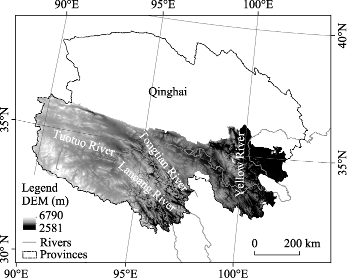
The Three-River Headwaters (TRH), which is the source area of Yangtze River, Yellow River and Lancang River, is vulnerable and sensitive, and its alpine ecosystem is considered an important barrier for China’s ecological security. Understanding the impact of climate changes is essential for determining suitable measures for ecological environmental protection and restoration against the background of global climatic changes. However, different explanations of the interannual trends in complex alpine ecosystems have been proposed due to limited availability of reliable data and the uncertainty of the model itself. In this study, the remote sensing-process coupled model (GLOPEM-CEVSA) was used to estimate the net primary productivity (NPP) of vegetation in the TRH region from 2000 to 2012. The estimated NPP significantly and linearly correlated with the above-ground biomass sampled in the field (the multiple correlative coefficient R2 = 0.45, significant level P < 0.01) and showed better performance than the MODIS productivity product, i.e. MOD17A3, (R2 = 0.21). The climate of TRH became warmer and wetter during 1990-2012, and the years 2000 to 2012 were warmer and wetter than the years1990-2000. Responding to the warmer and wetter climate, the NPP had an increasing trend of 13.7 g m-2 (10 yr)-1 with a statistical confidence of 86% (P = 0.14). Among the three basins, the NPP of the Yellow River basin increased at the fastest rate of 17.44 g m-2 (10 yr)-1 (P = 0.158), followed by the Yangtze River basin, and the Lancang River, which was the slowest with a rate of 12.2 g m-2 (10 yr)-1 and a statistical confidence level of only 67%. A multivariate linear regression with temperature and precipitation as the independent variables and NPP as the dependent variable at the pixel level was used to analyze the impacts of climatic changes on the trend of NPP. Both temperature and precipitation can explain the interannual variability of 83% in grassland NPP in the whole region, and can explain high, medium and low coverage of 78%, 84% and 83%, respectively, for grassland in the whole region. The results indicate that climate changes play a dominant role in the interannual trend of vegetation productivity in the alpine ecosystems on Qinghai-Tibetan Plateau. This has important implications for the formulation of ecological protection and restoration policies for vulnerable ecosystems against the background of global climate changes.
Based on vegetation survey data and environmental data of the Yarlung Zangbo River Basin, we conducted a quantitative ecological analysis of the vegetation community composition and the relationship between species and the environment in the study area. The results showed that 44 sampling sites and 68 plant species in the study area can be classified into seven subtypes: Artemisia minor + Stipa purpurea; Artemisia demissa + Stipa purpurea + Artemisia wellbyi; Kobresia pygmaea; Trikeraia hookeri; Sophora moorcroftiana + Cotoneaster multiflorus + Pennisetum centrasiaticum; Artemisia frigida; Potentilla fruticosa + Orinus thoroldii. Detrended correspondence analysis (DCA) indicated that both longitude and altitude play important roles in site and species distribution patterns. In addition, canonical correspondence analysis (CCA) revealed that in the upper and middle reaches of the Yarlung Zangbo River Basin, changes in temperature and precipitation caused by longitude are the main factors controlling the formation and transition of vegetation community types. Moreover, natural vegetation could be divided into three types: desert steppe community (source area), alpine steppe community (middle reaches region), and shrub community (confluence of Yarlung Zangbo River and Nyangqu River).
Extreme climate events play an important role in studies of long-term climate change. As the Earth’s Third Pole, the Tibetan Plateau (TP) is sensitive to climate change and variation. In this study on the TP, the spatiotemporal changes in climate extreme indices (CEIs) are analyzed based on daily maximum and minimum surface air temperatures and precipitation at 98 meteorological stations, most with elevations of at least 4000 m above sea level, during 1960-2012. Fifteen temperature extreme indices (TEIs) and eight precipitation extreme indices (PEIs) were calculated. Then, their long-term change patterns, from spatial and temporal perspectives, were determined at regional, eco-regional and station levels. The entire TP region exhibits a significant warming trend, as reflected by the TEIs. The regional cold days and nights show decreasing trends at rates of -8.9 d (10 yr)-1 (days per decade) and -17.3 d (10 yr)-1, respectively. The corresponding warm days and nights have increased by 7.6 d (10 yr)-1 and 12.5 d (10 yr)-1, respectively. At the station level, the majority of stations indicate statistically significant trends for all TEIs, but they show spatial heterogeneity. The eco-regional TEIs show patterns that are consistent with the entire TP. The growing season has become longer at a rate of 5.3 d (10 yr)-1. The abrupt change points for CEIs were examined, and they were mainly distributed during the 1980s and 1990s. The PEIs on the TP exhibit clear fluctuations and increasing trends with small magnitudes. The annual total precipitation has increased by 2.8 mm (10 yr)-1 (not statistically significant). Most of the CEIs will maintain a persistent trend, as indicated by their Hurst exponents. The developing trends of the CEIs do not show a corresponding change with increasing altitude. In general, the warming trends demonstrate an asymmetric pattern reflected by the rapid increase in the warming trends of the cold TEIs, which are of greater magnitudes than those of the warm TEIs. This finding indicates a positive shift in the distribution of the daily minimum temperatures throughout the TP. Most of the PEIs show weak increasing trends, which are not statistically significant. This work aims to delineate a comprehensive picture of the extreme climate conditions over the TP that can enhance our understanding of its changing climate.
In this paper we present a stochastic model for daily average temperature to calculate the temperature indices upon which temperature-based derivatives are written. We propose a seasonal mean and volatility model that describes the daily average temperature behavior using the mean-reverting Ornstein-Uhlenbeck process. We also use higher order continuous-time autoregressive process with lag 3 for modeling the time evolution of the temperatures after removing trend and seasonality. Our model is fitted to 11 years of data recorded, in the period 1 January 2005 to 31 December 2015, Bahir Dar, Ethiopia, obtained from Ethiopia National Meteorological Services Agency. The analytical approximation formulas are used to price heating degree days (HDD) and cooling degree days (CDD) futures. The suggested model is analytically tractable for derivation of explicit prices for CDD and HDD futures and option. The price of the CDD future is calculated, using analytical approximation formulas. Numerical examples are presented to indicate the accuracy of the method. The results show that our model performs better to predict CDD indices.
In recent years, with the rapid development of China’s economy, the coastal environment is facing large pressure. However, the coastal environment pollution has not attracted much attention as air pollution and land water pollution. Based on the data on economic development and marine ecosystem environmental pollution which collected from the National Bureau of Statistics and China’s coastal marine environmental monitoring, the paper analyzes the overall coastal ecosystem environment pollution in China as well as the four sea areas the Bohai Sea, the Yellow Sea, the East China Sea and South China Sea. The paper finds that the coastal marine environment pollution differ in different sea areas, taking the seawater quality, over-standard pollutants, water quality of rivers entering seas and coastal marine environmental disasters, such as red tide as index. Couple of policy suggestions provided based on research findings.
The phytoplankton group’s composition is an excellent indicator of the state of coastal waters. The aim of this study is to explore spatial variability of phytoplankton in shallow coastal areas from different regions (East, Center and West) of the Algerian coast. The quantitative and qualitative study of the phytoplankton population was conducted on samples taken during the 2012-2013 period by the research vessel GRINE BELKACEM. The qualitative results show a significant diversity of diatoms and dinoflagellates, which rank first and second in the total flora (Fr > 50%). This finding is also confirmed quantitatively by the abundance values in both 2013 and 2012 samples which largely exceeds the average value in most other areas of the western region (56%) and slightly exceeding 52% in all central areas which represent an equi-distribution between diatoms and dinoflagellates. The Dinoflagellates contribute significantly to the quantitative richness in the eastern region (>60%). The minimum value of Dia/Dino index, recorded in the eastern region confirms the dominance of the dinoflagellates especially in Skikda (0.31) (Skikda).However, our results reveal the presence, in smaller proportion, of other groups such as the cocolithophoridae and euglenophyceae.
Site-specific nutrient management is an important strategy to promote sustainable production of rubber trees in order to obtain high yields of natural rubber. Making effective nutrient management decisions for rubber trees depend on knowing the spatial variations of soil fertility properties in advance. In this study the Kriging geostatistical method was used to examine the spatial variability of soil total nitrogen (TN), organic matter (OM), available phosphorus (AP) and available potassium (AK) in a typical hilly rubber tree plantation in Hainan, China. The spatial variability of the soils was small for the TN and OM and had medium variability for the AP and AK variables. Anisotropic semivariograms of all soil properties revealed that elevation and building contour ledge can profoundly affect the spatial variability of soil properties in the plantation, except for the AK variable. Soil samples had to be collected in alignment with the direction of elevation and perpendicular to the direction of building contour ledges, which was needed to obtain more reliable information within the study area in the rubber tree plantation. In formulating a sample scheme for AK, the distribution features of the soil’s parent material should be considered as the influence factor in the study field. The Kriging method used to guide the soil sampling for spatial variability dertermination of soil properties was about 2-5 times more efficient than the classic statistical method.
With a comparatively mature state of country park development for China, Hong Kong serves as a model that is emulated by many cities in Mainland China. In contrast, Beijing started to establish country parks relatively late, but along with the nascent “Country Park Loop”, achieving scientific and reasonable operation management is now the major challenge facing Beijing. By comparing the differences between Hong Kong and Beijing country park management in terms of positioning, management organization, legal guarantees, supporting facilities and education, this paper explores the factors of social development stage, urban developmental history and planning, the wilderness concept and financial support which are responsible for those differences. In order to achieve sustainable development, this paper shows that Beijing country parks should seek corresponding solutions according to their own characteristics.